- English
Languages:
This site is created using Wikimapia data. Wikimapia is an open-content collaborative map project contributed by volunteers around the world. It contains information about 32593799 places and counting.
Learn more about Wikimapia and cityguides.
Akole
Tehsil Akole, District Ahmednagar, Maharashtra.
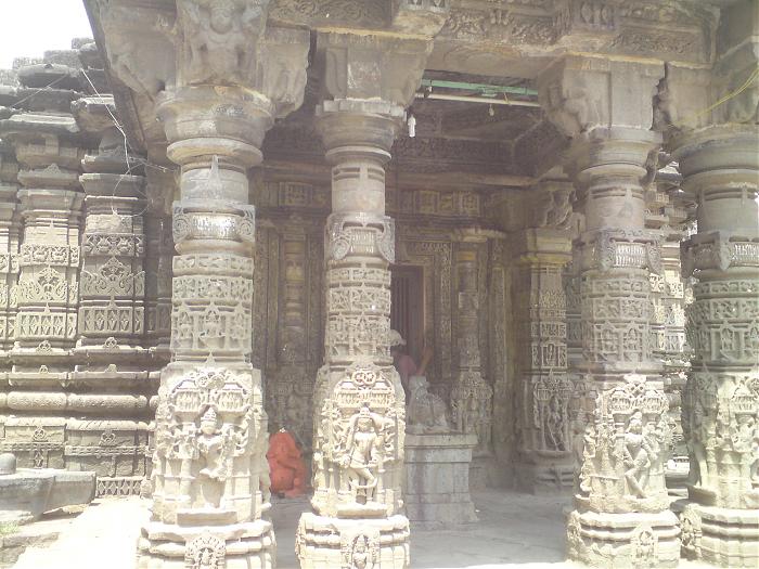
Akole is a taluka headquarters situated on the banks of the Pravara, about 14 km east of Rajur, in Ahmednagar District. This taluka has various tourist places like Harishchandragad, Kalsubaai (The highest peak in maharashtra), ratangad, sandan vally, randha fall, umbrela fall. You will get all information at Akolemaza portal ( www.akolemaza.com ).
It lies 11 km north-west of Kotul and about 25 km from Shendi. Shirdi, the Sai Baba pilgrim spot, Loni, Bhandardara Dam, Umbrella Falls and Kalasubai Harischandragad Wildlife Sanctuary are some prominent tourist spots, within easy access from Akola. En route to Shindi, one can visit the Arthur Lake. Aurangabad Airport and Pune Lohegaon Airport serve Akola. Closest Railway Stations: Belapur Railway Station and Igatpuri Railway Station.
Wikipedia article: http://en.wikipedia.org/wiki/Akole
Tehsil Akole, District Ahmednagar, Maharashtra.
Akole is a taluka headquarters situated on the banks of the Pravara, about 14 km east of Rajur, in Ahmednagar District. This taluka has various tourist places like Harishchandragad, Kalsubaai (The highest peak in maharashtra), ratangad, sandan vally, randha fall, umbrela fall. You will get all information at Akolemaza portal ( www.akolemaza.com ).
It lies 11 km north-west of Kotul and about 25 km from Shendi. Shirdi, the Sai Baba pilgrim spot, Loni, Bhandardara Dam, Umbrella Falls and Kalasubai Harischandragad Wildlife Sanctuary are some prominent tourist spots, within easy access from Akola. En route to Shindi, one can visit the...
 Reduce description
Akole on the map.


Recent city comments: